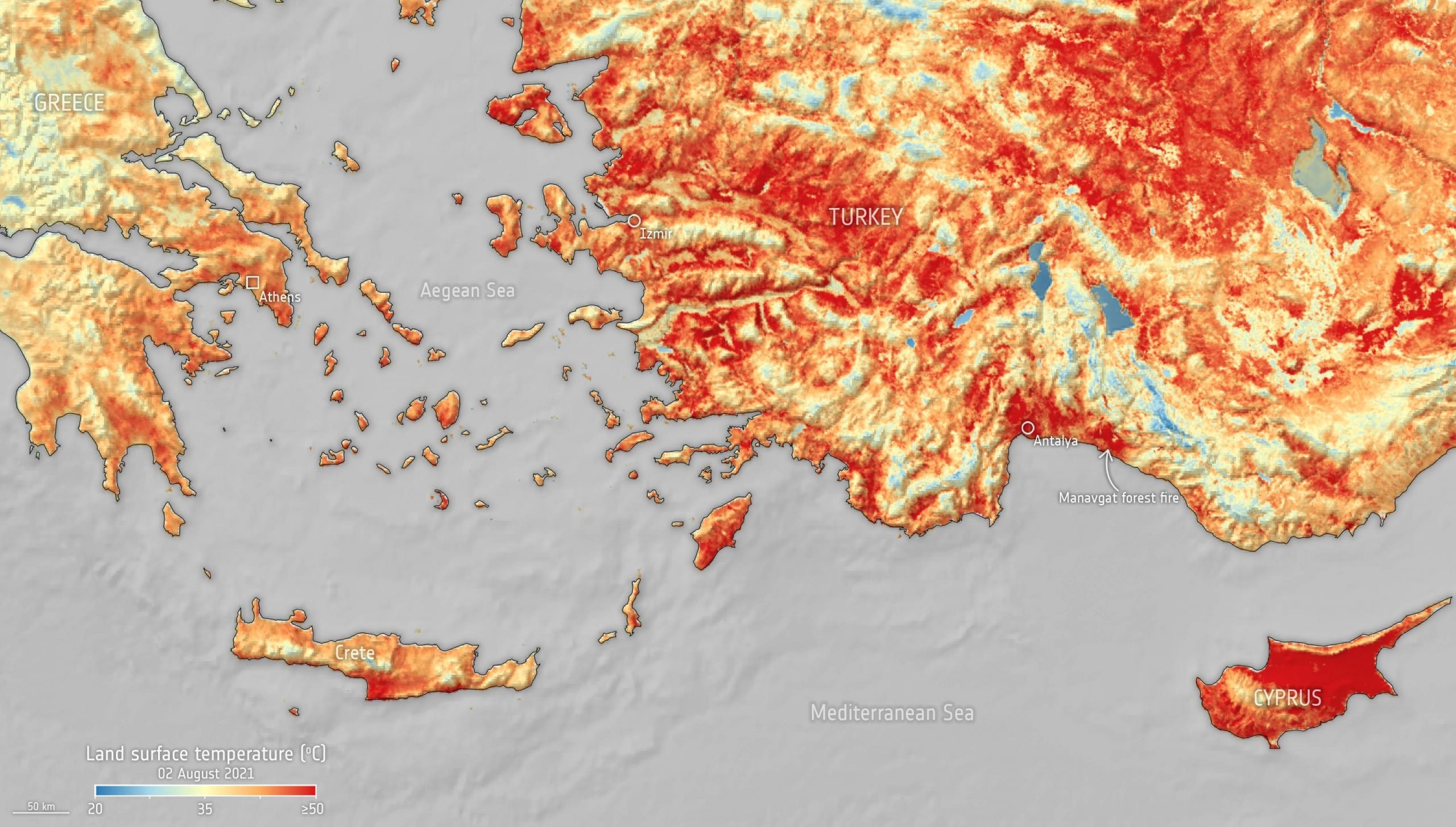
This map shows the temperature of the land surface on August 2, 2021. It is clear to see that surface temperatures in Turkey and Cyprus have reached over 50°C (~122°F), again. A map from June 30 (at the bottom of this article) shows pretty much the same situation. The Mediterranean has been suffering a heatwave for some weeks, leading to numerous wildfires. Turkey, for example, is reported to be amid the country’s worst blazes in at least a decade.
The map here was generated using data from Copernicus Sentinel-3’s Sea and Land Surface Temperature Radiometer. While weather forecasts use predicted air temperatures, this satellite instrument measures the real amount of energy radiating from Earth – and dipicts the real temperature of the land surface.
The Copernicus Sentinel-3 satellites also carry camera-like instruments, which captured smoke billowing from the fires in Turkey on July 30.
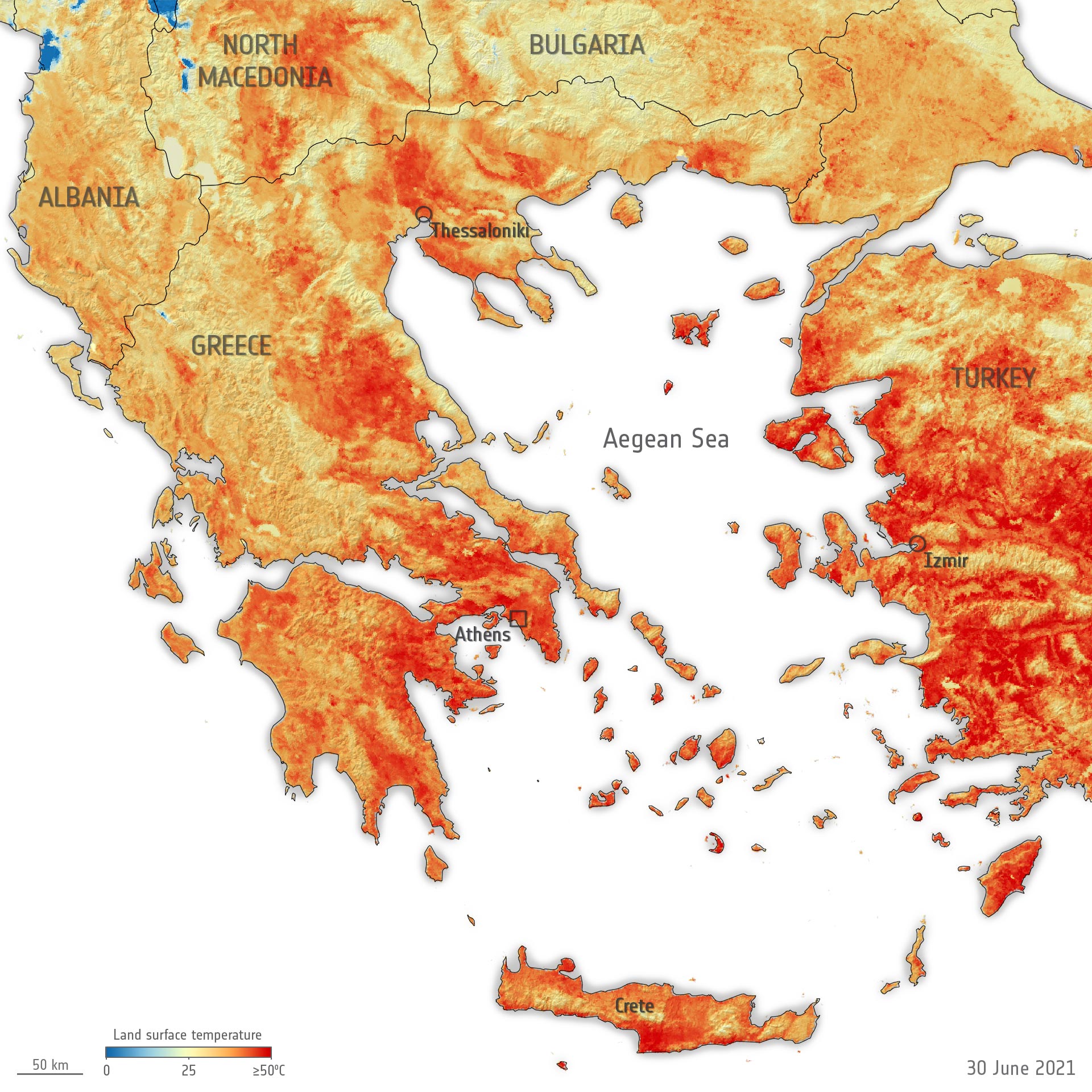
Scorching temperatures hit both Greece and Turkey at the end of June 2021, leading to the temporary closure of the Acropolis – Greece’s most visited monument. This map shows the land surface temperature of Greece and surrounding countries on June 30. The data show that surface temperatures reached over 50°C in many locations including the northwest of Athens and many regions in Turkey. The blue spots visible near Albania are clouds. Credit: Contains modified Copernicus Sentinel data (2021), processed by ESA, CC BY-SA 3.0 IGO
Published at scitechdaily.com


